


Why Developers and Architects Rely on Topographical Surveys
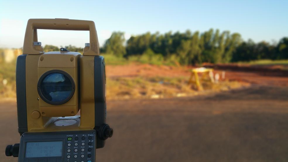
When planning a construction project, one of the first steps is understanding the land. A topographical survey provides detailed information about the land’s surface, including elevation, natural features, and man-made structures. Developers and architects use these surveys to make informed decisions, prevent costly mistakes, and ensure that their designs align with the land’s characteristics. Without accurate data, construction projects can face delays, unexpected expenses, and compliance issues.
This article explores why professionals rely on topographical surveying and how it impacts construction and development.
1. Understanding the Land’s Features
A topographical survey captures essential details about the land, such as slopes, trees, rivers, and existing buildings. Architects use this data to design structures that fit the environment, while developers use it to assess the feasibility of a project. If the land has uneven terrain, the survey will highlight areas that need leveling or special foundation work.
Without this information, construction teams may encounter surprises that lead to budget overruns. A well-planned survey reduces these risks by giving a clear picture of the land before any work begins.
2. Avoiding Construction Challenges
Land often has hidden challenges like underground utilities, drainage issues, or unstable soil. A topographical survey identifies these factors early, allowing developers to plan around them. For example, if a survey reveals that an area is prone to flooding, engineers can design drainage solutions before starting construction. This proactive approach helps prevent costly repairs and delays.
Similarly, knowing the exact location of underground cables or pipelines prevents accidental damage. Digging without accurate data can result in utility disruptions, fines, and safety hazards. A survey ensures that all potential problems are identified before breaking ground.
3. Complying with Regulations and Approvals
Local authorities often require detailed land surveys before granting construction permits. A topographical survey helps developers meet these requirements by providing precise land measurements and identifying zoning restrictions. Without the correct documentation, a project could face legal hurdles, leading to delays or even cancellations.
By submitting accurate survey data, developers can speed up the approval process and gain the confidence of regulatory bodies. This also ensures that the project complies with environmental regulations, building codes, and land-use policies.
4. Reducing Costs and Delays
Every construction project comes with financial risks. Without proper planning, unexpected site issues can increase costs. A topographical survey helps avoid these surprises by giving developers a clear understanding of the land from the start.
For example, if a survey reveals that the land has significant elevation changes, the developer can budget for necessary grading work in advance. Without this information, the cost of adjusting the land could disrupt the entire project’s budget.
Additionally, accurate data allows teams to work efficiently, reducing wasted time and materials. Projects that rely on precise planning are more likely to stay on schedule and within budget.
5. Supporting Architectural Design
Architects use topographical surveying to create designs that match the land’s unique characteristics. If a building is planned on a slope, for instance, the architect can design it to blend with the landscape rather than requiring extensive land modification.
A well-executed survey ensures that buildings are positioned correctly to maximize views, natural light, and energy efficiency. It also helps architects plan drainage systems and access roads that work with the land instead of against it. Without a detailed survey, designs may require major adjustments later, leading to wasted resources and design conflicts.
6. Ensuring Structural Stability and Safety
A poorly planned construction project can result in unsafe buildings. A topographical survey helps engineers assess whether the land is suitable for construction and what modifications may be needed to ensure stability.
For example, some areas may have soil that cannot support heavy structures without reinforcement. Knowing this in advance allows builders to take necessary precautions, such as using deep foundations or stabilizing the ground.
Safety extends beyond the structure itself. Surveys also help plan safe access roads, parking areas, and pedestrian pathways, reducing the risk of accidents on the site.
7. Planning Infrastructure and Utilities
Construction projects need well-planned infrastructure, including roads, drainage, and utility connections. A topographical survey helps engineers design these elements efficiently.
For instance, a survey can show the best locations for water drainage systems, preventing flooding or erosion. It can also highlight existing utility lines, ensuring that new connections are made without causing damage.
By using accurate land data, developers can avoid infrastructure problems that could cause major setbacks once the project is underway.
8. Helping with Property Valuation
A topographical survey also plays a role in property valuation. Buyers and investors want to know the true characteristics of a site before purchasing it. If a piece of land has steep slopes or requires significant preparation work, its value may be lower than expected.
Accurate survey data allows developers to make informed investment decisions. It also helps them present detailed site reports to potential investors, increasing transparency and trust in the project.
9. Impact on Project Efficiency
A construction project is most successful when everything runs smoothly. A topographical survey helps by eliminating uncertainties and improving communication between teams. Engineers, architects, and contractors can work together more effectively when they have reliable land data.
With accurate survey results, teams can plan logistics, order materials efficiently, and allocate resources wisely. This coordination results in faster completion times and fewer errors, ensuring that projects meet deadlines and budget goals.
10. Understanding the Cost of Topographic Surveys
One of the common concerns developers and industry professionals have is the topographic survey cost. The price varies depending on several factors, including:
- The size of the land
- The complexity of the terrain
- The level of detail required
- The location of the property
While surveys do come at a cost, they save money in the long run by preventing errors, reducing delays, and ensuring that projects comply with regulations.
Conclusion
A topographical survey is a critical tool for developers and architects. It provides essential data that ensures a project is safe, cost-effective, and well-planned. From understanding land features to avoiding construction challenges, these surveys help professionals make smart decisions that lead to successful projects.
Investing in a detailed survey can save time, money, and effort in the long run. Whether you’re planning a small development or a large commercial project, having accurate land data is the first step toward success.